

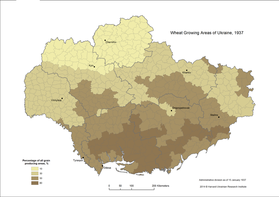
2. Wheat Growing Areas of Ukraine, 1937
Overview
This map visualizes data from Volodomyr Kubijovyc’s “Atlas of Ukraine and Adjoining Countries,” showing estimates of wheat growing areas as a percentage of all grain producing land in each of Ukraine's districts in the 1930s.
This maps shows four classes of grain producing land, indicated by color shading.
- The lightest shade indicates an area with 10 percent wheat growing land.
- The second lightest shade indicates an area with 30 percent wheat growing land.
- The second darkest shade indicates an area with 50 percent wheat growing land.
- The darkest shade indicates an area with 80 percent wheat growing land.
Sources
Volodymyr Kubijovyč. Atlias Ukrainy i sumezhnikh kraïv (Atlas of Ukraine and Adjoining Countries). Lʹviv: Ukrainsʹkyi vydavnychyi instytut, 1937. #28. p.XXVII.